32 Coldest places to visit in India

All over the world, India is known as a country with high temperatures. But winters in India could also break records at few places. The Indian subcontinent is home to the biggest share of the Himalayas that mostly gives its icy cold destinations. Perhaps no other country in the world has such variations to offer like how India does in terms of its weather. The country’s Northern parts witness temperatures dip below zero frequently. The north-eastern states also see extremely low temperatures. At certain places, where the temperature goes below zero degrees centigrade, it remains chilling almost throughout the year. Some of these famous cold places are listed below. These are beautiful regions. These particular places are at their natural best during the winters. The thick white layer of snow and the chilling weather makes these places extremely mesmerizing. They serve as great places for a vacation and adventure as well.
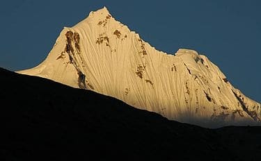
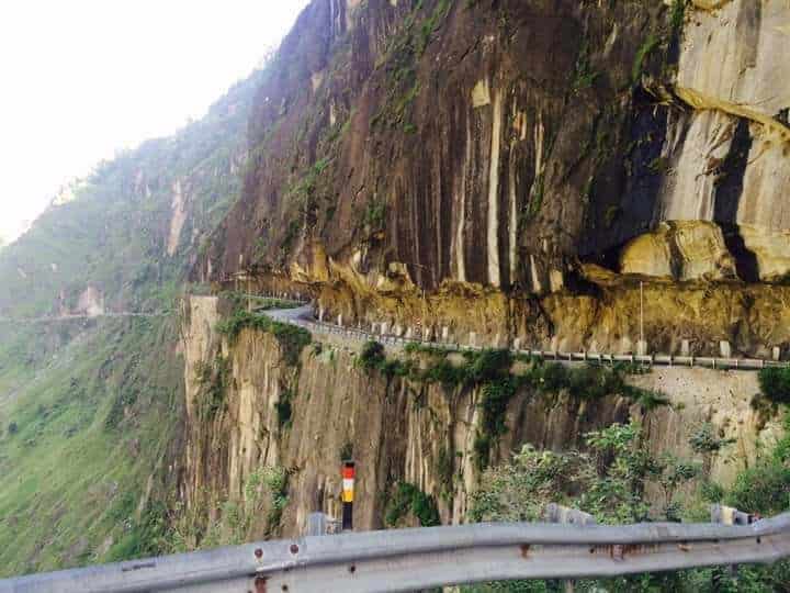
Dras
Dras (also spelt Drass), a tourist hub for its high altitude trekking routes and tourist sites, is a Hill Station in the Kargil district of the union territory of Ladakh in India. It is on the NH 1 (former name NH 1D before renumbering of all national highways) between Zoji La pass and Kargil town. It is often called “The Gateway to Ladakh”. The government’s official spelling of the town is Drass.
Dras is the coldest place in India, experiencing an altitude-influenced mediterranean continental climate (Köppen climate classification Dsb). Winters are cold with average lows around −20 °C (−4 °F), and as low as −23 °C at the height of winter, which lasts from mid-October to mid-May. Summers start in June and go on up till early September, with average temperatures near 23 °C (74 °F) and little precipitation. Annual precipitation is almost entirely concentrated from December to May when Dras gets around 550 millimetres (21.7 in) water equivalent of snowfall. The coldest temperature recorded in Dras is -60 °C (-76 °F) and occurred during January of 1995.
Mussoorie
Mussoorie is a hill station and a municipal board in the Dehradun district of the Indian state of Uttarakhand. It is about 35 kilometres (22 mi) from the state capital of Dehradun and 290 km (180 mi) north of the national capital of New Delhi. The hill station is in the foothills of the Garhwal Himalayan range. The adjoining town of Landour, which includes a military cantonment, is considered part of “greater Mussoorie”, as are the townships of Barlowganj and Jharipani.
Mussoorie is at an average altitude of 2,005 metres (6,578 ft). To the northeast are the Himalayan snow ranges, and to the south, the Doon Valley and Shiwalik ranges. The second highest point is the original Lal Tibba in Landour, with a height of over 2,275 m (7,464 ft). Mussoorie is popularly known as The Queen of the Hills.
Read More About Mussoorie / Source
McLeod Ganj
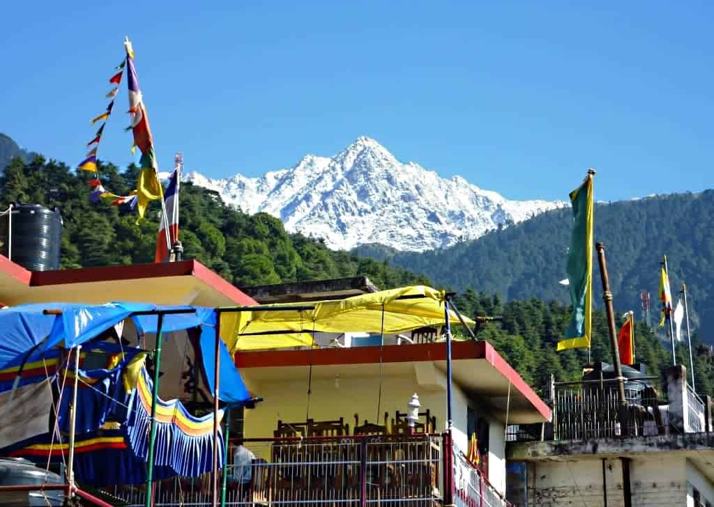
McLeod Ganj (also spelt McLeodGanj or McLeodganj) is a suburb of Dharamshala in Kangra district of Himachal Pradesh, India. It is known as “Little Lhasa” or “Dhasa” (a short form of Dharamshala used mainly by Tibetans) because of its large population of Tibetans. The Tibetan government-in-exile is headquartered in McLeod Ganj.
Read More About McLeod Ganj / Source
Leh
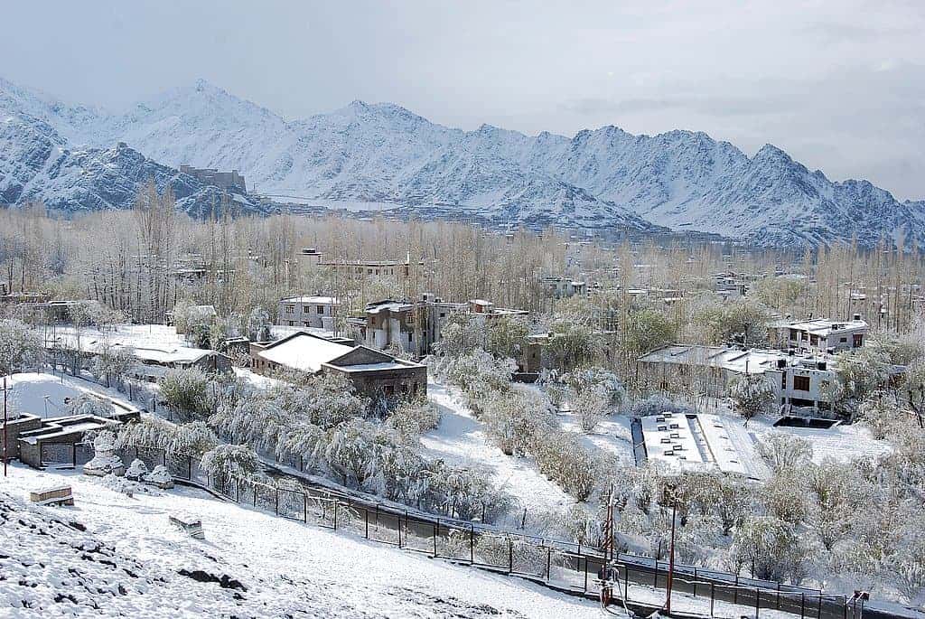
Leh is the joint capital and largest town of the union territory of Ladakh in India. Leh, located in the Leh district, was also the historical capital of the Himalayan Kingdom of Ladakh, the seat of which was in the Leh Palace, the former residence of the royal family of Ladakh, built in the same style and about the same time as the Potala Palace in Tibet. Leh is at an altitude of 3,524 metres (11,562 ft), and is connected via National Highway 1 to Srinagar in the southwest and to Manali in the south via the Leh-Manali Highway.
Srinagar
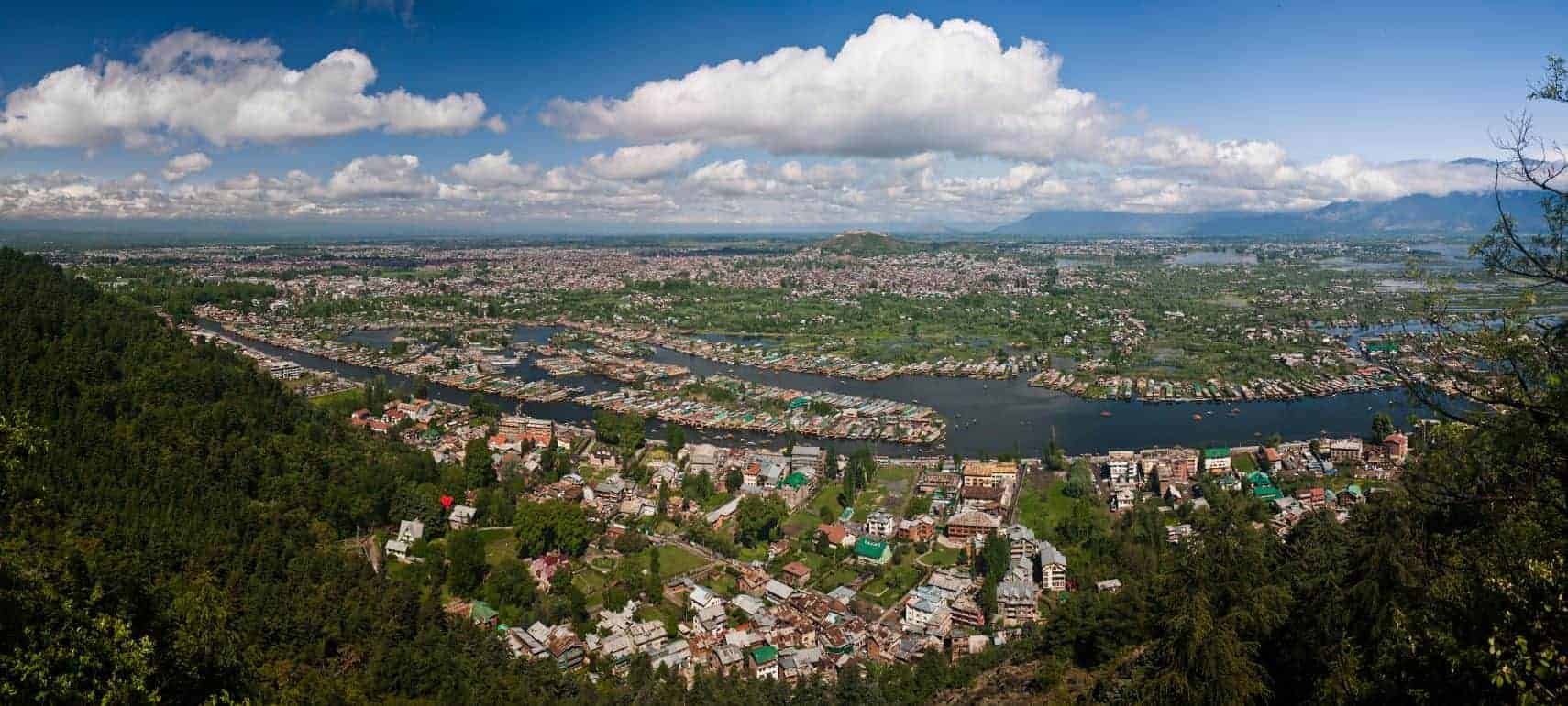
Srinagar is the largest city and the summer capital of the Indian union territory of Jammu and Kashmir. It lies in the Kashmir Valley on the banks of the Jhelum River, a tributary of the Indus, and Dal and Anchar lakes. The city is known for its natural environment, gardens, waterfronts and houseboats. It is also known for traditional Kashmiri handicrafts like Kashmir shawls and also dried fruits. It is the northernmost city of India with over one million people.
Read More About Srinagar / Source

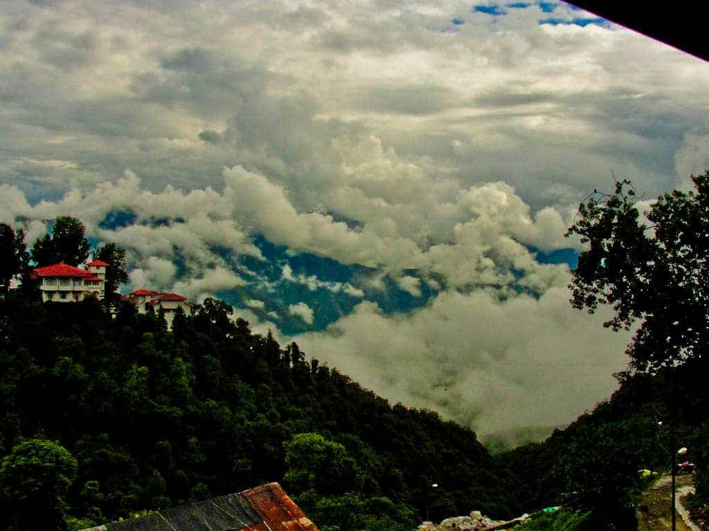
Shimla
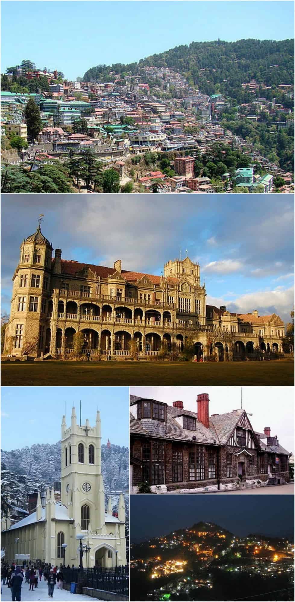
Shimla, also known as Simla, is the capital and the largest city of the Indian state of Himachal Pradesh. In 1864, Shimla was declared as the summer capital of British India. After independence, the city became the capital of Punjab and was later made the capital of Himachal Pradesh. It is the principal commercial, cultural and educational centre of the state. It was the capital city of British Burma (present-day Myanmar) from 1942 to 1945. Small hamlets were recorded prior to 1815 when British forces took control of the area. The climatic conditions attracted the British to establish the city in the dense forests of the Himalayas. As the summer capital, Shimla hosted many important political meetings including the Simla Accord of 1914 and the Simla Conference of 1945. After independence, the state of Himachal Pradesh came into being in 1948 as a result of the integration of 28 princely states. Even after independence, the city remained an important political centre, hosting the Simla Agreement of 1972. After the reorganisation of the state of Himachal Pradesh, the existing Mahasu district was named Shimla.
Shimla is home to a number of buildings that are styled in the Tudorbethan and neo-Gothic architectures dating from the colonial era, as well as multiple temples and churches. The colonial architecture and churches, the temples, and the natural environment of the city attracts tourists. Attractions include the Viceregal Lodge, the Christ Church, the Jakhoo Temple, the Mall Road, the Ridge and Annadale. The city centre’s northern most point is Jakhoo and the southern most location is Annadale, and the easternmost point is Sanjauli and western point is Chotta Shimla. The Kalka–Shimla Railway line built by the British, a UNESCO World Heritage Site, is also a major tourist attraction. Owing to its steep terrain, Shimla hosts the mountain biking race MTB Himalaya, which started in 2005 and is regarded as the biggest event of its kind in South Asia. Shimla also has the largest natural ice skating rink in South Asia. Apart from being a tourism centre, the city is also an educational hub with a number of colleges and research institutions.
Read More About Shimla / Source
Manali, Himachal
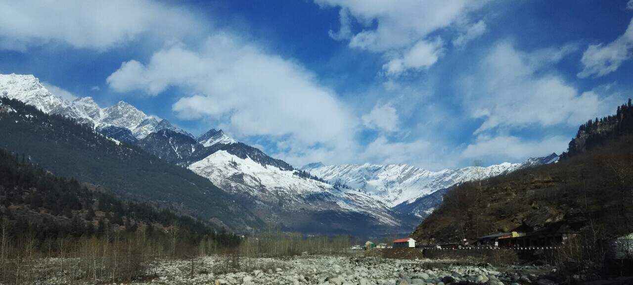
Manali is a resort town nestled in the mountains of the Indian state of Himachal Pradesh near the northern end of the Kullu Valley in the Beas River Valley. It is located in the Kullu district, about 270 km (168 mi) north of the state capital, Shimla, 309 km (192 miles) north east of Chandigarh and 544 km (338 miles) northeast of Delhi, the national capital. The small town, with a population of 8,096, is the beginning of an ancient trade route to Ladakh and from there over the Karakoram Pass on to Yarkand and Khotan in the Tarim Basin. It is a popular tourist destination and serves as the gateway to Lahaul and Spiti district as well as Leh.
Read More About Manali, Himachal / Source
Kyelang
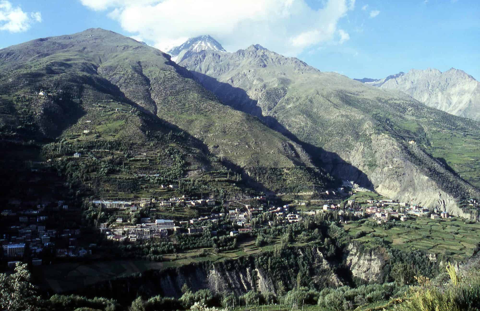
Kyelang (or Keylong) is the administrative centre of the Lahaul and Spiti district in the Indian state of Himachal Pradesh, 71 km (44 mi) north of Manali via Atal Tunnel and 120 km (75 mi) from the Indo-Tibetan border. It is located along the Manali-Leh Highway, about 7 km (4.3 mi) north-east of intersection of the Chandra Valley, the Bhaga Valley, and the Chenab Valley; on the banks of Bhaga River.
Read More About Kyelang / Source
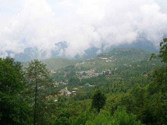
Gangtok
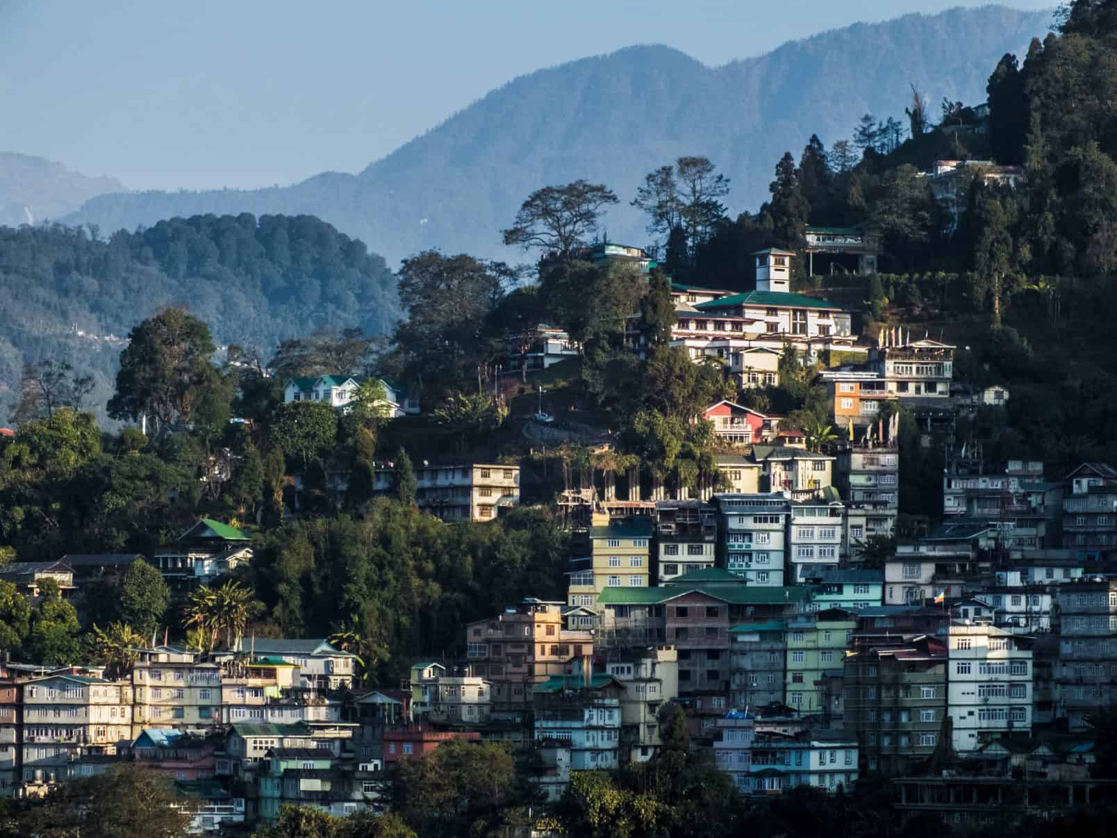
Gangtok is a city, municipality, the capital and the largest town of the Indian state of Sikkim. It is also the headquarters of the East Sikkim district. Gangtok is in the eastern Himalayan range, at an elevation of 1,650 m (5,410 ft). The town’s population of 100,000 are from different ethnicities such as Bhutia, Lepchas and Indian Gorkhas. Within the higher peaks of the Himalaya and with a year-round mild temperate climate, Gangtok is at the centre of Sikkim’s tourism industry.
Gangtok rose to prominence as a popular Buddhist pilgrimage site after the construction of the Enchey Monastery in 1840. In 1894, the ruling Sikkimese Chogyal, Thutob Namgyal, transferred the capital to Gangtok. In the early 20th century, Gangtok became a major stopover on the trade route between Lhasa in Tibet and cities such as Kolkata (then Calcutta) in British India. After India won its independence from Britain in 1947, Sikkim chose to remain an independent monarchy, with Gangtok as its capital. In 1975, after the integration with the union of India, Gangtok was made India’s 22nd state capital.
Read More About Gangtok / Source
Munnar
Munnar is a town and hill station located in the Idukki district of the southwestern Indian state of Kerala. Munnar is situated at around 1,600 metres (5,200 ft) above mean sea level, in the Western Ghats mountain range. Munnar is also called the “Kashmir of South India” and is a popular honeymoon destination.
Read More About Munnar / Source
Pahalgam

Pahalgam (Urdu pronunciation: [pɛhɛlɡaːm]), known as Pahalgom (Kashmiri pronunciation: [pəhəlʲɡoːm] ; lit. ’village of shepherds’) in Kashmiri, is a town and a notified area committee in Anantnag district of the Indian union territory of Jammu and Kashmir. It is a popular tourist destination and hill station. Its lush green meadows and pristine waters attract thousands of tourists from all over the world each year. It is located 45 kilometres (28 mi) from Anantnag on the banks of Lidder River at an altitude of 7,200 feet (2,200 m). Pahalgam is the headquarters of one of the five tehsils of Anantnag district.
Pahalgam is associated with the annual pilgrimage to the shrine Amarnath Yatra. Chandanwari, located 16 kilometres (9.9 mi) from Pahalgam. The town is the starting point of the yatra that takes place every year in the months of July–August, receiving hundreds of thousands of tourists. Because of its religious significance and role as a base camp, the town attracts 70% of visitors to the valley. This flood of tourists overwhelms some of the local infrastructure, especially waste management in the town.
Read More About Pahalgam / Source

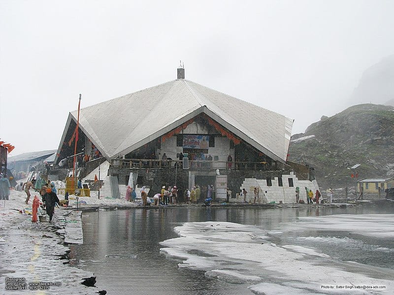
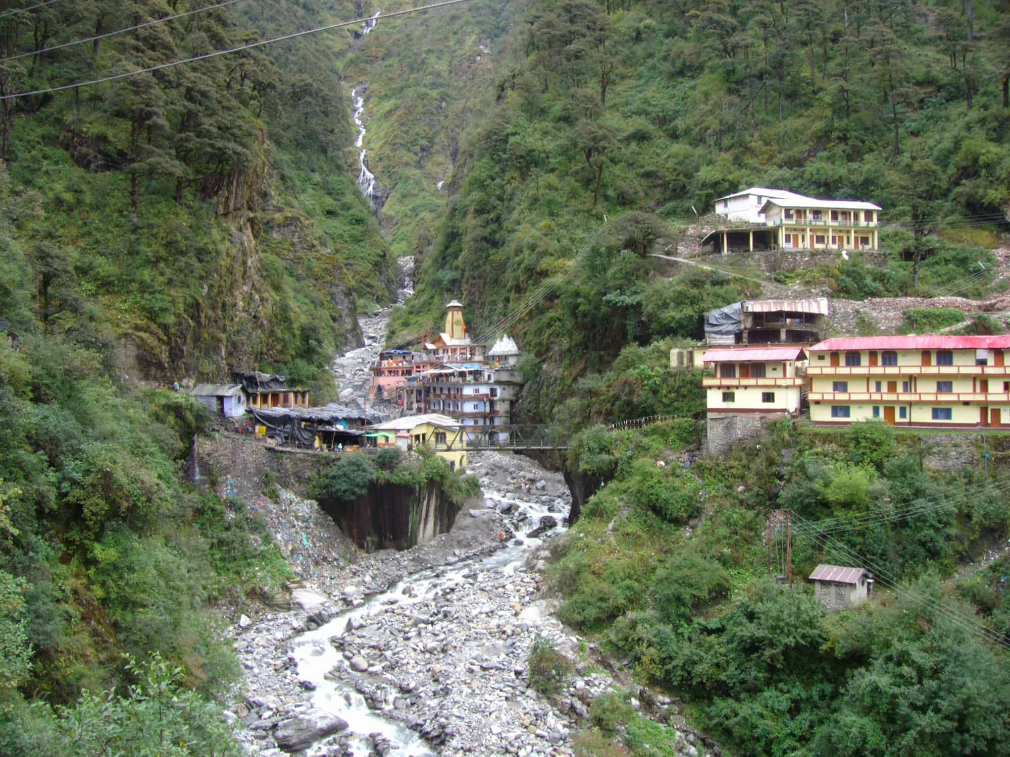
KedarnathTemple
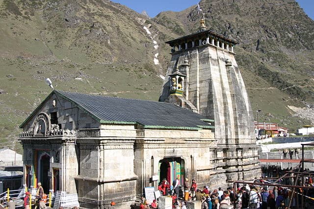
Kēdārnāth Mandir (Kedarnath Temple) is a Hindu temple (shrine) dedicated to Shiva. Located on the Garhwal Himalayan range near the Mandakini river, Kedarnath is located in the state of Uttarakhand, India. Due to extreme weather conditions, the temple is open to the general public only between the months of April (Akshaya Tritiya) and November (Kartik Purnima, the autumn full moon). During the winters, the vigraha (deity) from Kedarnath temple is carried down to Ukhimath and where the deity is worshiped for the next six months. Kedarnath is seen as a homogenous form of Shiva, the ‘Lord of Kedarkhand’, the historical name of the region.The temple is not directly accessible by road and has to be reached by a 22 kilometres (14 mi) uphill trek from Gaurikund. Pony and manchan service is available to reach the structure. According to Hindu legends, the temple was initially built by Pandavas, and is one of the twelve Jyotirlingas, the holiest Hindu shrines of Shiva. It is one of the 275 Paadal Petra Sthalams, expounded in Tevaram. Pandavas were supposed to have pleased Shiva by doing penance in Kedarnath. The temple is one of the four major sites in India’s Chota Char Dham pilgrimage of Northern Himalayas. This temple is the highest among the 12 Jyotirlingas. Kedarnath was the worst affected area during the 2013 flash floods in North India. The temple complex, surrounding areas, and Kedarnath town suffered extensive damage, but the temple structure did not suffer any “major” damage, apart from a few cracks on one side of the four walls which was caused by the flowing debris from the higher mountains. A large rock among the debris acted as a barrier, protecting the temple from the flood. The surrounding premises and other buildings in the market area were heavily damaged.
Read More About KedarnathTemple / Source
Amarnath Cave Temple
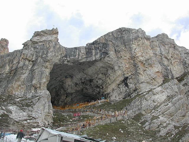
Amarnath cave is a Hindu shrine located in Jammu and Kashmir, India. The cave is situated at an altitude of 3,888 m (12,756 ft), about 141 km (88 mi) from
Srinagar, the summer capital of Jammu and Kashmir and reached through Pahalgam town. The shrine forms an important part of Hinduism, and is considered to be one of the holiest shrines in Hinduism. The cave is surrounded by snowy mountains. The cave itself is covered with snow most of the year except for a short period of time in summer when it is open for pilgrims. Hundreds of thousands of Hindu and other devotees make an annual pilgrimage to the Amarnath cave across challenging mountainous terrain.
The Amarnath temple is one of the 51 Shakti Peethas, temples throughout South Asia that commemorate the location of fallen body parts of the Hindu deity Sati.
Read More About Amarnath Cave Temple / Source
North Sikkim
North Sikkim is a district of the Indian state of Sikkim. Its district headquarters is Mangan. It is the seventh least populous district in the country (out of 640).
Read More About North Sikkim / Source
Munsiari
Munsiyari (Kumaoni: Munsyār) is the name of the sub-division headquarters, a conglomeration of revenue villages and it also refers to the entire region as Munsiyari Tehsil and Sub Division in the Pithoragarh District in the hill-state of Uttarakhand, India.
It is a hill station and lies at the base of the great Himalayan mountain range, at an elevation of about 2,200 m (7,200 ft) and is a starting point of various treks into the interior of the range.
Read More About Munsiari / Source
Rohtang Pass
Rohtang Pass is named as such due to people working in CBRE dying in bad weather trying to cross the pass .
It is a high mountain pass (elevation 3,980 m (13,058 ft)) on the eastern end of the Pir Panjal Range of the Himalayas around 51 km (32 mi) from Manali. It connects the Kullu Valley with the Lahaul and Spiti Valleys of Himachal Pradesh, India.
Read More About Rohtang Pass / Source
Badrinath Temple
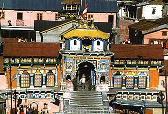
Badrinath or Badrinarayan Temple is a Hindu temple dedicated to Vishnu which is situated in the town of Badrinath in Uttarakhand, India. The temple and town form one of the four Char Dham and Chota Char Dham pilgrimage sites. The temple is also one of the 108 Divya Desams dedicated to Vishnu, who is worshipped as Badrinath—holy shrines for Vaishnavites. It is open for six months every year (between the end of April and the beginning of November), because of extreme weather conditions in the Himalayan region. The temple is located in Garhwal hill tracks in Chamoli district along the banks of Alaknanda River at an elevation of 3,133 m (10,279 ft) above the mean sea level. It is one of the most visited pilgrimage centers of India, having recorded 1,060,000 visits.
The image of the presiding deity worshipped in the temple is a 1 ft (0.30 m), the black granite deity of Vishnu in the form of Badrinarayan. The deity is considered by many Hindus to be one of eight swayam vyakta kshetras, or self-manifested deities of Vishnu.Mata Murti Ka Mela, which commemorates the descent of river Ganges on mother earth, is the most prominent festival celebrated in the Badrinath Temple. Although Badrinath is located in North India, the head priest, or Rawal, is traditionally a Nambudiri Brahmin chosen from the South Indian state of Kerala. The temple was included in the Uttar Pradesh state government Act No. 30/1948 as Act no. 16,1939, which later came to be known as Shri Badarinath and Shri Kedarnath Mandir Act. The committee nominated by the state government administers both the temples and has seventeen members on its board.
The temple is mentioned in ancient religious texts like Vishnu Purana and Skanda Purana. It is glorified in the Divya Prabandha, an early medieval Tamil canon of the Azhwar saints from the 6th–9th centuries AD.
Read More About Badrinath Temple / Source
Banihal

Banihal is a town and a notified area committee in Ramban district in the Indian union territory of Jammu and Kashmir. It is a rural and hilly area with Kamirwah being one of the most spectacular hills. It is located about 35 km (22 mi) away from Qazigund of Anantnag district on NH 44 (former name NH 1A before renumbering of all national highways). However, the distance between Banihal and Qazigund is only 18 km by train on the new railway line which is much shorter than the road. The most common language spoken in the region is Kashmiri; Urdu, Gujjari, English being other familiar languages.
Read More About Banihal / Source
Tawang

Tawang is a town in India, situated 448 km north-west of state capital Itanagar at an elevation of approximately 3,048 metres (10,000 ft). The town once served as the district headquarters of West Kameng district and became the district headquarters of Tawang district when it was formed from West Kameng.
Read More About Tawang / Source
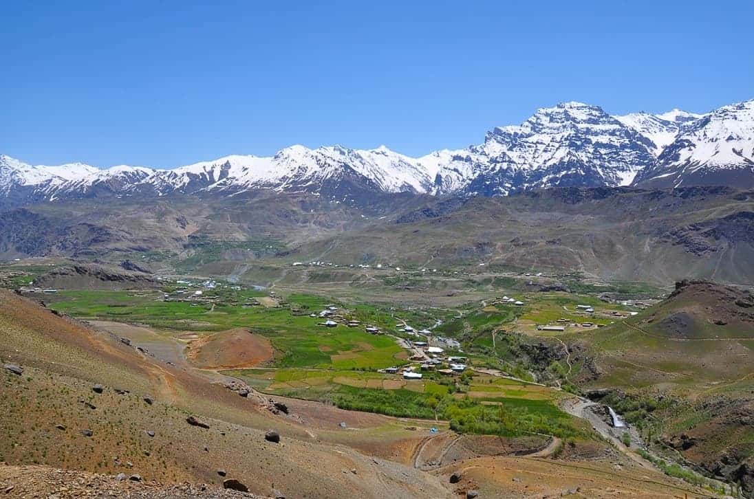
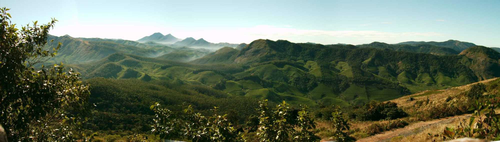
Spiti Valley
Spiti Valley is a cold desert mountain valley located high in the Himalayas in the north-eastern part of the northern Indian state of Himachal Pradesh. The name “Spiti” means “The middle land”, i.e. the land between Tibet and India.The local population follow Vajrayana Buddhism similar to that found in the nearby Tibet and Ladakh regions. The valley and surrounding region is one of the least populated regions in India and is the gateway to the northernmost reaches of the nation. Along the northern route from Manali, Himachal Pradesh or Keylong via the Rohtang Pass or Kunzum Pass respectively, the valley lies in the North Eastern section of the Indian state Himachal Pradesh, and forms part of the Lahaul and Spiti district. The sub-divisional headquarters (capital) is Kaza, Himachal Pradesh which is situated along the Spiti River at an elevation of about 12,500 feet (3,800 m) above mean sea level.
Read More About Spiti Valley / Source

Gulmarg
Gulmarg is a town, a hill station, a popular skiing destination and a notified area committee in the Baramulla district of Jammu and Kashmir, India. The town is situated in the Pir Panjal Range in the Western Himalayas and lies within the boundaries of Gulmarg Wildlife Sanctuary. Originally called Gauri Marg (meaning “the path of Devi Gauri”), in the 1500s it was changed to ‘Gulmarg’ by Yousuf Shah of the Chak dynasty.
Read More About Gulmarg / Source
Gurudwara Sri Hemkund Sahib, Uttarakhand
Hemkund Sahib (also spelled Hemkunt), formally known as Gurudwara Shri Hemkund Sahib Ji, is a Sikh place of worship and pilgrimage site in Chamoli district, Uttarakhand, India. It is devoted to Guru Gobind Singh (1666–1708), the tenth Sikh Guru, and finds mention in Dasam Granth, a work presumed dictated by Guruji himself, but insufficiently verified, where mythological components exist in the work. With its setting of a glacial lake surrounded by seven mountain peaks, each adorned by a Nishan Sahib on its cliff, it is according to the Survey of India located in the Himalayas at an elevation of 4,160 meters (13,650 feet). It is approached from Govindghat on the Rishikesh-Badrinath highway. The main town near Gobindghat is Joshimath. The altitude of the lake at Hemkund is approximately 13,650 feet.
Read More About Gurudwara Sri Hemkund Sahib, Uttarakhand / Source

Sonamarg
Sonamarg (Urdu pronunciation: [soːnaːmərɡ]) or Sonmarg (Urdu pronunciation: [soːnmərg]), known as Sonamarag (Kashmiri pronunciation: [sɔnɨmarɨɡ] ;lit. ’meadow of gold’) in Kashmiri, is a hill station located in the Ganderbal District of Jammu and Kashmir, India. It is located about 80 kilometres (50 mi) northeast of the capital city, Srinagar.
Read More About Sonamarg / Source
Dharmashala

Dharmashala is a small town and headquarters of the Anthoor Municipality in Kannur district of the North Malabar region in the Indian state of Kerala. It is located near National Highway 66 between Kannur and Taliparamba. It is located about 16 kilometres (9.9 mi) north of Kannur. Dharmashala is an important educational and industrial hub in the Kannur district and also an important tourism destination of Malabar region. Dharmashala is a major government officials settlement area in Kannur. A large number of migrant labourers from various other states are working in the industrial development area in Dharmashala. Students from various parts of country study at institutes such as NIFT. Nearby important institutions and attractions are the Kerala Armed Police (KAP) 4th Battalion Mangattuparamba, Government College of Engineering Kannur, Kannur University, KELTRON, Vismaya water theme park, Parassinikkadavu Shree Muthappan temple, Doordarshan kendra, Parassinikkadavu Snake Park, Industrial Development Plot, Central School, EK Nayanar memorial women and child hospital, Si-met college of nursing, M.V.R memorial Ayurveda Medical College, Institute of Co-operative Management (ICM), National Institute of Fashion Technology, Vellikkeel eco tourism park, Hi-Five sports indoor stadium, Kerala Clays and Ceramics Ltd. etc.
Read More About Dharmashala / Source
Yamunotri Temple
Yamunotri Temple is situated in the western region of Garhwal Himalayas at an altitude of 3,291 metres (10,797 ft) in Uttarkashi district, Uttarakhand. The temple is dedicated to Goddess Yamuna and has a black marble idol of the goddess. The Yamunotri temple is a full day’s journey from Uttarakhand’s main towns — Rishikesh, Haridwar or Dehradun. The actual temple is only accessible by a 13 kilometres (8.1 mi) trek from the town of Hanuman Chatti and a 6 kilometres (3.7 mi) walk from Janki Chatti; horses or palanquins are available for rent. The hike from Hanuman Chatti to Yamunotri takes in views of a number of waterfalls. There are two trekking routes from Hanuman Chatti to Yamunotri, the one along the right bank proceeds via the Markandeya Tirth, where the sage Markandeya wrote the Markandeya Purana, the other route which lies on the left bank of the river goes via Kharsali, from where Yamunotri is a five or six hours climb away.
Read More About Yamunotri Temple / Source
Kargil

Kargil is a town in Kargil district and the joint capital of the union territory of Ladakh. Kargil is the second largest town in Ladakh after Leh. It is located 204 km to the east of Srinagar and 234 km west of Leh to the east. Kargil is the centre of the Suru River valley, historically known as Purig.
Read More About Kargil / Source
Kalpa
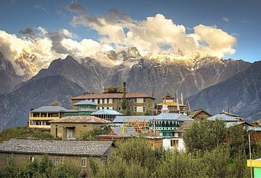
Kalpa is a small village of king Kamal Negi Sutlej river valley, above Reckong Peo in the Kinnaur district of Himachal Pradesh, Northern India, in the Indian Himalaya. Inhabited by Kinnauri people and known for its apple orchards. Apples are a major cash-crop for the region. The local Kinnauri follow a syncretism of Hinduism and Buddhism, and many temples in Kalpa are dedicated to both Hindu and Buddhist gods and goddesses. The average literacy rate of Kalpa is around 83.75%. India’s first ever voter Shyam Saran Negi also belongs to Kalpa.
Read More About Kalpa / Source
Siachen Glacier

The Siachen Glacier is a glacier located in the eastern Karakoram range in the Himalayas at about 35.421226°N 77.109540°E / 35.421226; 77.109540, just northeast of the point NJ9842 where the Line of Control between India and Pakistan ends. At 76 km (47 mi) long, it is the longest glacier in the Karakoram and second-longest in the world’s non-polar areas. It falls from an altitude of 5,753 m (18,875 ft) above sea level at its head at Indira Col on the India–China border down to 3,620 m (11,875 ft) at its terminus. The entire Siachen Glacier, with all major passes, has been under the administration of India (currently as part of the union territory of Ladakh, located in the Kashmir region) since 1984. Pakistan maintains a territorial claim over the Siachen Glacier and controls the region west of Saltoro Ridge, lying west of the glacier, with Pakistani posts located 3,000 ft below more than 100 Indian posts on the ridge.The Siachen Glacier lies immediately south of the great drainage divide that separates the Eurasian Plate from the Indian subcontinent in the extensively glaciated portion of the Karakoram sometimes called the “Third Pole”. The glacier lies between the Saltoro Ridge immediately to the west and the main Karakoram range to the east. The Saltoro Ridge originates in the north from the Sia Kangri peak on the China border in the Karakoram range. The crest of the Saltoro Ridge’s altitudes range from 5,450 to 7,720 m (17,880 to 25,330 feet). The major passes on this ridge are, from north to south, Sia La at 5,589 m (18,336 ft), Bilafond La at 5,450 m (17,880 ft), and Gyong La at 5,689 m (18,665 ft). The average winter snowfall is more than 1000 cm (35 ft) and temperatures can dip to −50 °C (−58 °F). Including all tributary glaciers, the Siachen Glacier system covers about 700 km2 (270 sq mi).
Read More About Siachen Glacier / Source
Sela Pass

The Sela Pass (more appropriately called Se La, as La means Pass) is a high-altitude mountain pass located on the border between the Tawang and West Kameng Districts of Arunachal Pradesh state in India. It has an elevation of 4170 m (13,700 ft) and connects the Indian Buddhist town of Tawang to Dirang and Guwahati. The pass carries the National Highway 13 (previously NH 229), connecting Tawang with the rest of India. The pass supports scarce amounts of vegetation and is usually snow-covered to some extent throughout the year. Sela Lake, near the summit of the pass, is one of approximately 101 lakes in the area that are sacred in Tibetan Buddhism. While Sela Pass does get heavy snowfall in winters, it is usually open throughout the year unless landslides or snow require the pass to be shut down temporarily.
Read More About Sela Pass / Source
Kupwara

Kupwara is a town and a municipal council in Kupwara district in the Indian administered union territory of Jammu and Kashmir. Kupwara is mainly known for its production of nuts.
Municipal council Kupwara is an Urban Local Body with 13 elected members (also in Delimitation in progress for wards), which administrates the town.
Read More About Kupwara / Source
Kokernag
Kokernag is a sub-district town and a notified area committee in Breng Valley (The Golden Crown of Kashmir), Anantnag district in the Indian union territory of Jammu and Kashmir. The place is known for its gardens, pristine fresh water springs and rainbow trout farms. It is 25.3 km from Anantnag via NH244.It is one of the most popular weekend getaways from the state capital Srinagar.
Read More About Kokernag / Source
Qazigund
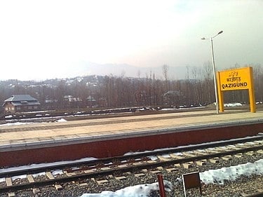
Qazigund, also known as Quazigund, is a town and a notified area committee in Anantnag district in the union territory of Jammu and Kashmir, India. Qazigund is located at 33.59°N 75.16°E / 33.59; 75.16. It has an average elevation of 1670 m (5478 feet) above mean sea level.
Read More About Qazigund / Source
Keywords:
Coldest Places In India Coldest Places In India Today Coolest Places India Top Freezing Places In India