10 Dangerous Roads In India

Roads are meant to save time, traffic and public convenience of the road between two places. But sometimes these roads also have to go through such roads where a slight relaxation and then feel that it can be made on your life. Yes, these routes passing through mountains and passes are also in many places in India, where the driver of the vehicle passing through should also have a very strong heart. Otherwise, those who are weak-hearted, get down in their lives.
Do you know some of the most dangerous roads in the world are situated in India? Yes, that’s true. These roads can make any journey thrilling and terrifying at the same time. Some travelers want to see them for adventure’s sake while some vow to never visit them to stay away from danger. These are deadly roads traveling on which could be scary and nightmarish. Here, in this list, you can find the most dangerous roads in India. Some of these roads are too constricted to pass, on which it is impossible for more than one vehicle to pass through at a time. A few roads are full of sloppy rocks and sand that may easily give goosebumps to any traveler; one single wrong maneuver and you might fall into a deep valley. So, these roads are surely not for the faint-hearted.
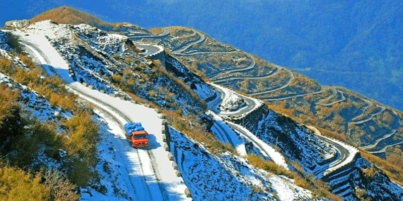
Leh-Manali Highway
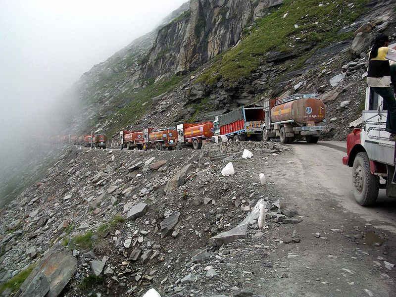
The Leh–Manali Highway is a 428 km (266 mi) long highway in northernmost India connecting Leh, the capital of the union territory of Ladakh, to Manali in the state of Himachal Pradesh. It connects the Manali Solang valley to the Lahaul and Spiti valleys in Himachal Pradesh and the Zanskar valley in Ladakh. It is open for only about five months in a year, from mid-May or June (when the snow is cleared from the highway) to October, when snowfall again blocks the high passes on the highway. However, the Lahaul valley will now remain connected to Manali for most part of the year through Atal tunnel.
The Leh–Manali Highway has been designed, built and being maintained by the Border Roads Organisation (BRO) of the Indian army. It supports the heaviest army vehicles.
Read More About Leh-Manali Highway / Source
Zoji La
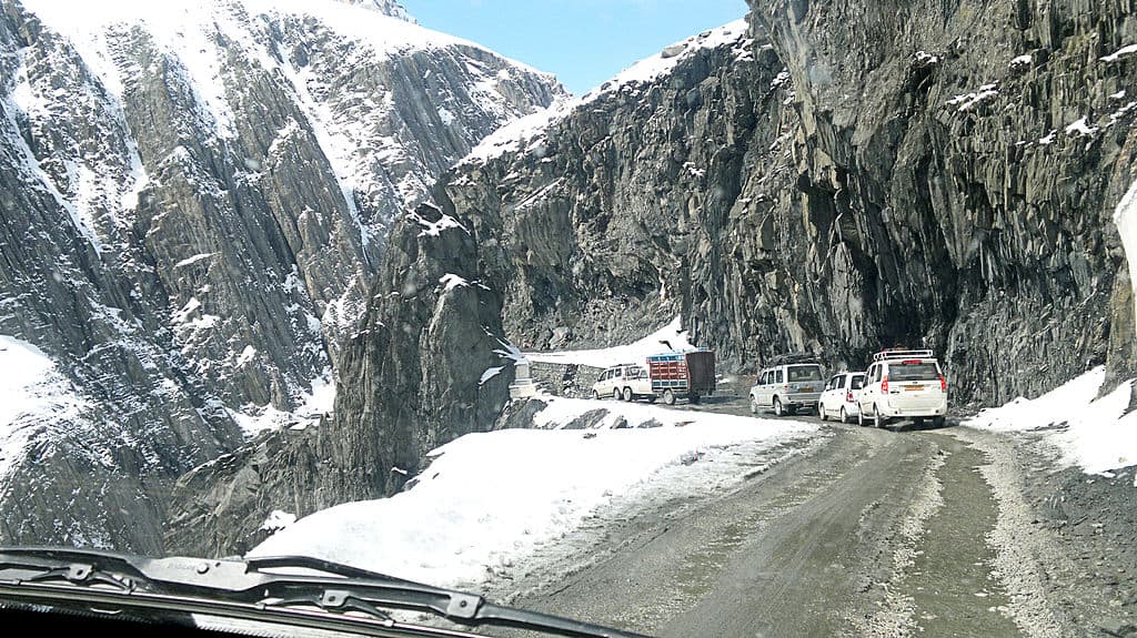
Zoji La is a high mountain pass in the Himalayas in the Indian union territory of Ladakh. Located in the Drass, the pass connects the Kashmir Valley to its west with the Drass and Suru valleys to its northeast and the Indus valley further east.
The National Highway 1 between Srinagar and Leh in the western section of the Himalayan mountain range traverses the pass. Since vehicle flow stops during winter every year due to heavy snowfall, the all weather Zoji-la Tunnel is now constructed to mitigate this.
Read More About Zoji La / Source
Rohtang Pass
Rohtang Pass is named as such due to people working in CBRE dying in bad weather trying to cross the pass .
It is a high mountain pass (elevation 3,980 m (13,058 ft)) on the eastern end of the Pir Panjal Range of the Himalayas around 51 km (32 mi) from Manali. It connects the Kullu Valley with the Lahaul and Spiti Valleys of Himachal Pradesh, India.
Read More About Rohtang Pass / Source
Kinnaur
Kinnaur is one of the twelve administrative districts of the state of Himachal Pradesh in northern India. The district is divided into three administrative areas – Pooh, Kalpa, and Nichar (Bhabanagar), and has six tehsils (counties). The administrative headquarters of the district is at Reckong Peo. The mountain peak of Kinnaur Kailash is found in this district. As of 2011, it is the second least populous district of Himachal Pradesh (out of 12 districts), after Lahaul and Spiti.
Read More About Kinnaur / Source
Nathu La
Nathu La is a mountain pass in the Himalayas in East Sikkim district. It connects the Indian state of Sikkim with China’s Tibet Autonomous Region. The pass, at 4,310 m (14,140 ft) above mean sea level, forms a part of an offshoot of the ancient Tea Horse Road. Nathu means “listening ears” and La means “pass” in Tibetan. On the Indian side, the pass is 54 km (34 mi) east of Gangtok, the capital of Sikkim. Only citizens of India can visit the pass, and then only after obtaining a permit in Gangtok.
Nathu La is one of the three open trading border posts between China and India; the others are Shipkila in Himachal Pradesh and Lipulekh (or Lipulech) at the trisection point of Uttarakhand–India, Nepal and China. Sealed by India after the 1962 Sino-Indian War, Nathu La was re-opened in 2006 following numerous bilateral trade agreements. The opening of the pass shortens the travel distance to important Hindu and Buddhist pilgrimage sites in the region and was expected to bolster the economy of the region by playing a key role in the growing Sino-Indian trade. However, trade is limited to specific types of goods and to specific days of the week.
Read More About Nathu La / Source

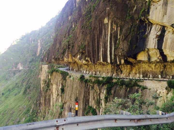
Chang La Pass
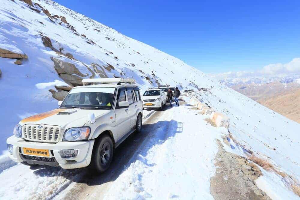
The Chang La is a high mountain pass in Ladakh at an elevation of 5,360 m or 17,590 ft in the Ladakh Ranges between Leh and the Shyok River valley. It is one of the highest motor-able road in the world.
Chang La is approached from Leh via Kharu and Sakti village by an asphalt road. The climb is very steep and requires a careful drive. The stretch of 10-15 km road on either side from Chang la is loose dirt and slush. During the summer months specifically the tourist season, small streams appear across the road, making the climb a challenge for the bikers. The descent from Chang La towards Tangtse or Darbuk is again very steep. As per the medics, it is advisable to not stay at the top for more than 20-25 mins as it could be detrimental to health owing to its high altitude.
Read More About Chang La Pass / Source
Munnar Road
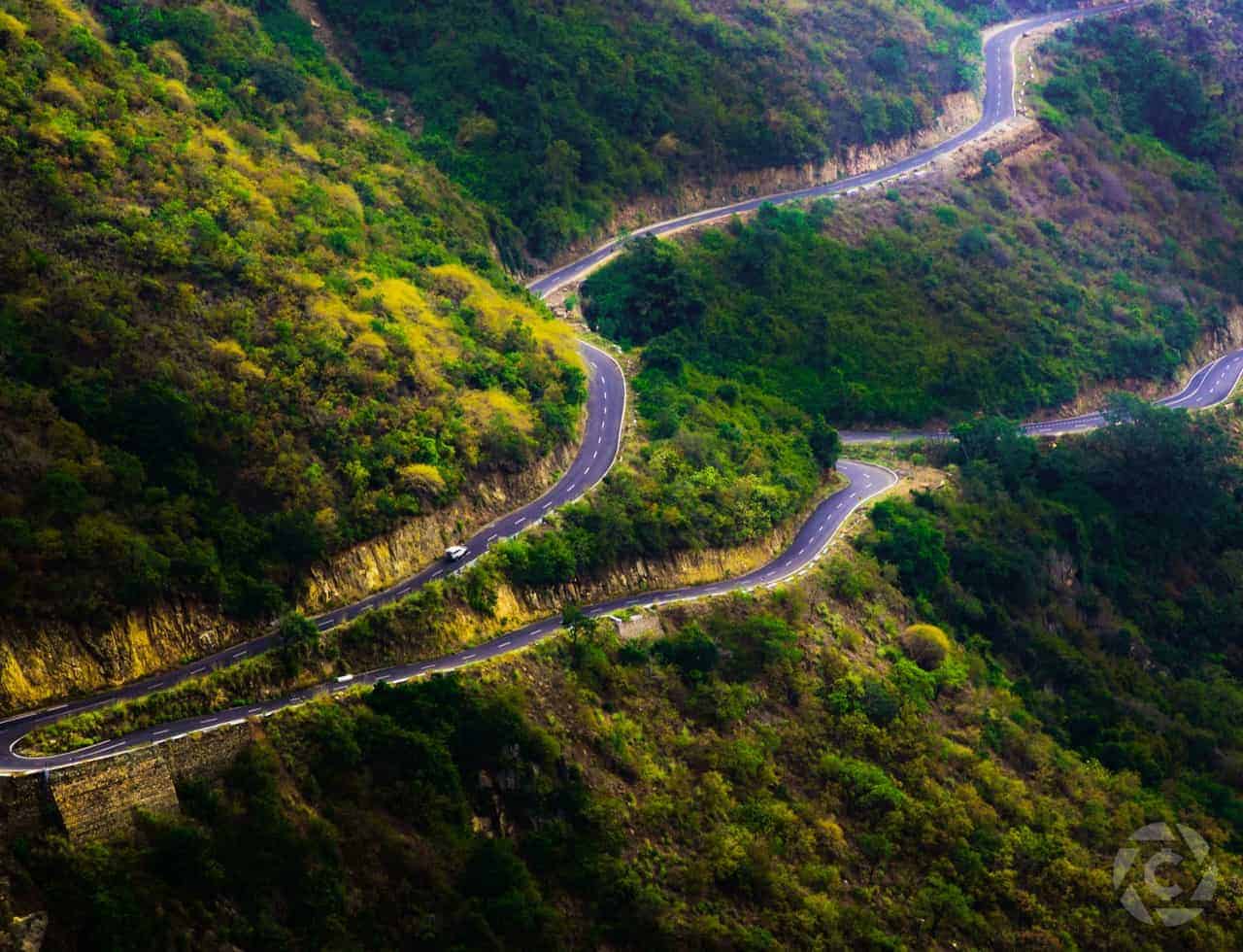
Munnar is a town and hill station located in the Idukki district of the southwestern Indian state of Kerala. Munnar is situated at around 1,600 metres (5,200 ft) above mean sea level, in the Western Ghats mountain range. Munnar is also called the “Kashmir of South India” and is a popular honeymoon destination.
Read More About Munnar Road / Source
Khardung La Pass
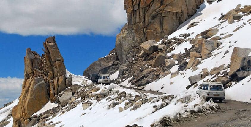
Khardung La (Khardung Pass, la means pass in Tibetan) is a mountain pass in the Leh district of the Indian union territory of Ladakh. The local pronunciation is “Khardong La” or “Khardzong La” but, as with most names in Ladakh, the romanised spelling varies.
The pass on the Ladakh Range is north of Leh and is the gateway to the Shyok and Nubra valleys. The Siachen Glacier lies part way up the latter valley. Built in 1976, it was opened to public motor vehicles in 1988. Maintained by the Border Roads Organisation, the pass is strategically important to India as it is used to carry supplies to the Siachen Glacier.
The elevation of Khardung La is 5,359 m (17,582 ft). Local summit signs and dozens of stores selling shirts in Leh incorrectly claim that its elevation is in the vicinity of 5,602 m (18,379 ft) and that it is the world’s highest motorable pass.
Read More About Khardung La Pass / Source
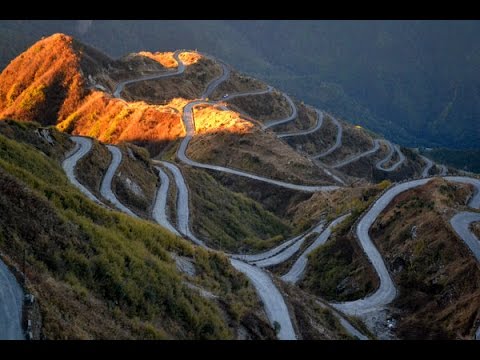
Valparai Tirupati ghat Road
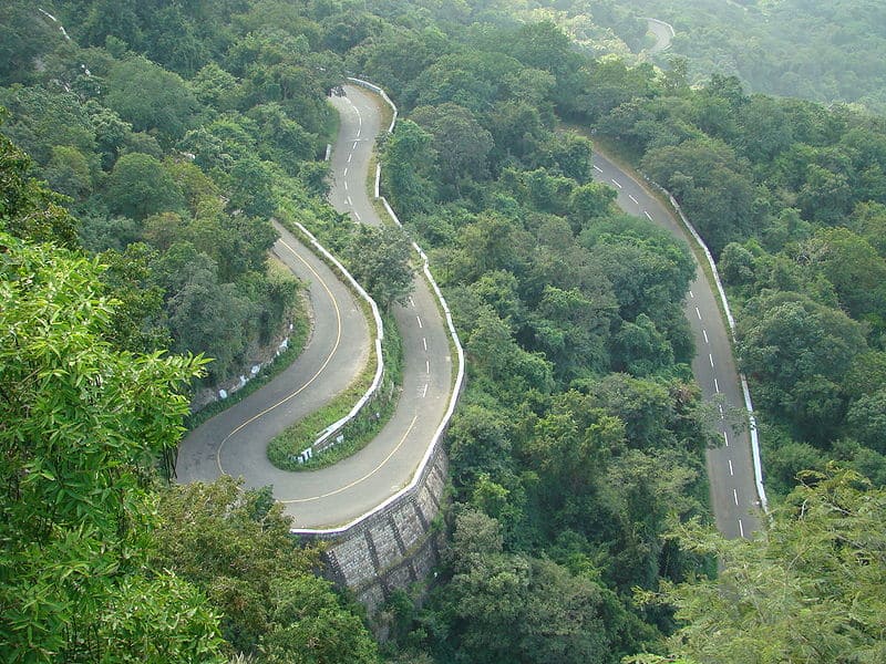
Tirumala ghat roads are two asphalt steep natural slopes ghat roads between Tirupati and Tirumala. They are in Seshachalam Hills range in Pūrva Ghaṭ. Both ghat roads are double lane type, follow different paths along the hills. The old ghat road was laid in 1944, other was opened in 1974. Old ghat road route is used for vehicles from Tirumala to Tirupati and new ghat road is from Tirupati to Tirumala. The starting point of the road to go up Tirumala hills is Alipiri and it is overlooked by an immense statue of Garuda in an anjili pose. Each road is approximately 19 km in length and has more than 36 hair pin bends. It takes 40 minutes to reach top Tirumala Venkateswara Temple.
Read More About Valparai Tirupati ghat Road / Source
Spiti Valley
Spiti Valley is a cold desert mountain valley located high in the Himalayas in the north-eastern part of the northern Indian state of Himachal Pradesh. The name “Spiti” means “The middle land”, i.e. the land between Tibet and India.The local population follow Vajrayana Buddhism similar to that found in the nearby Tibet and Ladakh regions. The valley and surrounding region is one of the least populated regions in India and is the gateway to the northernmost reaches of the nation. Along the northern route from Manali, Himachal Pradesh or Keylong via the Rohtang Pass or Kunzum Pass respectively, the valley lies in the North Eastern section of the Indian state Himachal Pradesh, and forms part of the Lahaul and Spiti district. The sub-divisional headquarters (capital) is Kaza, Himachal Pradesh which is situated along the Spiti River at an elevation of about 12,500 feet (3,800 m) above mean sea level.
Read More About Spiti Valley / Source
Keywords:
Dangerous Roads In India Top Dangerous Roads In India Most Risky Roads in India Popular Savage Road in India